![]()
Module for spatial data fusion and processing for real estate objects. estaty is Python-based platform to obtain and merge open spatial data with not very open and not very spatial to create “real estate use cases”. Library provide tools for loaded data merging, pairwise source verification, proximity analysis, etc.
Use the following commands to install this module
Using pip:
pip install estatyUsing poetry:
poetry add estatyThe variety of spatial data can be reduced to two large groups: raster and vector. Vector data can be presented as follows: point data, lines, polygons (Figure 1). So, estaty reduces completely all assimilated data to the following four types.

Figure 1. Possible types of spatial data
The module thus downloads spatial data in just four formats (1 raster fields and 3 vector). The module is designed so that the most important parts are isolated from each other (multi-layer architecture). The DataSource layer is responsible for loading and generalising the data. So, there are exists the following 5 layers:
DataSource- load and cache data, reduce data to known and commonly used types;Preprocessor- preprocessing operation to prepare data for merging. For example, assign new CRS (re-projection);Merger- merge raster and vector data if it is required;Analyzer- core of the system - use simple data representations and primitives to construct sequential analysis pipelines;Report- submodule for preparing PDF reports, data visualization and data send operations (for example POST request to desired service)
All above submodules can be flexibly configured to create custom data analysis pipelines:

Some use cases presented in a form of Python scripts - check examples folder for details.
The service is designed to create a separate approaches for analysis (we call it use cases). All of them can be found in the cases folder:
- area calculation - example of using the library to compare areas
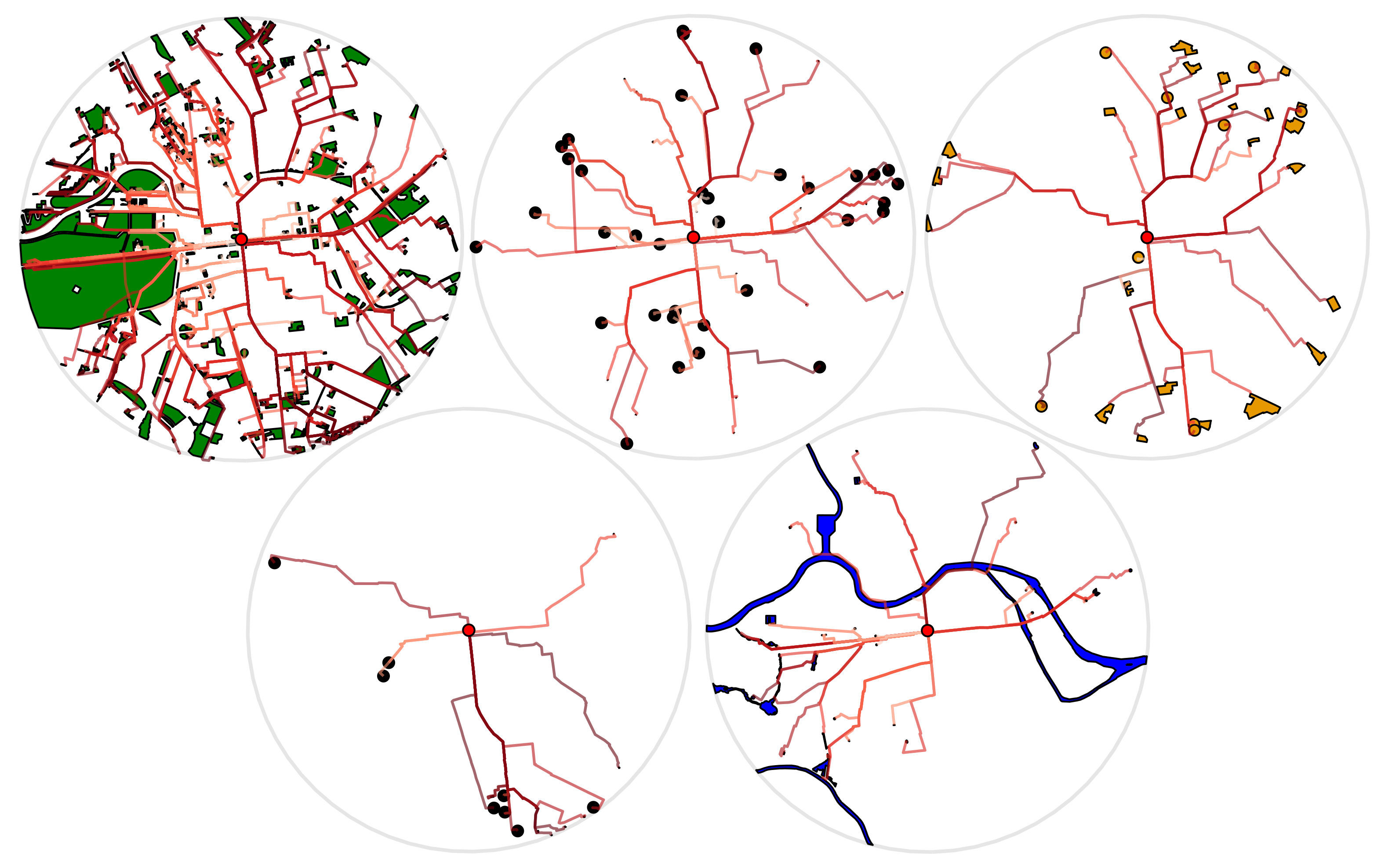
- proximity analysis - example of using the library to build routes to POIs (points of interest) of the required category and providing proximity analysis
Some release-related cases can be found via link https://github.com/wiredhut/estaty_examples
