Giter Site home page Giter Site logo

todd-lm / nycbikemap Goto Github PK

View Code? Open in Web Editor NEW
19.0 3.0 1.0 15.92 MB

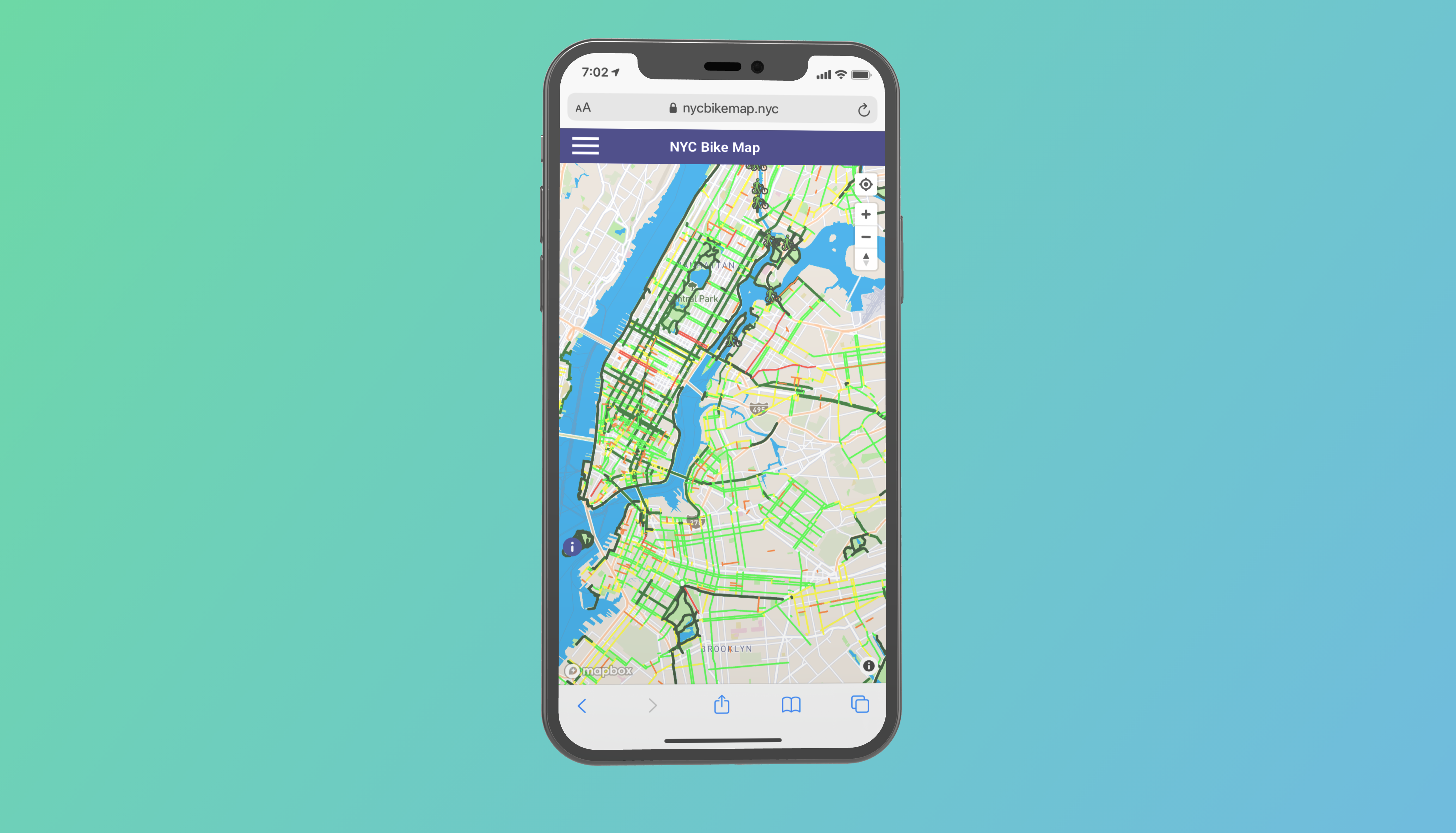
A web-based, unified, interactive bike map for NYC that combines information from NYC OpenData, Citi Bike and other sources.

Home Page: https://nycbikemap.nyc

CSS 16.10% HTML 9.80% JavaScript 74.10%
nyc bike map nyc-opendata mapbox-gl-js bikeshare bikenyc newyork-data

nycbikemap's Introduction

NYCBikeMap

A unified bike map for NYC that combines information from NYC OpenData, NYC DOT, Citi Bike and other publicly available sources.

nycbikemap screenshot

Sources Used:

Icons Used:

  • Bicycle Storage by Thomas Le Bas from the Noun Project
  • Bike Rack by Blair Adams from the Noun Project
  • Horizontal Two Way Arrow by Hunter Beal from the Noun Project
  • Right Arrow by Hunter Beal from the Noun Project
  • Hazard by Adrien Coquet from the Noun Project
  • Info by Poups from the Noun Project
  • walking bike by corpus delicti from the Noun Project
  • Stairs by Vadim Solomakhin from the Noun Project
  • Bicycle inside Elevator by Gan Khoon Lay from the Noun Project

nycbikemap's People

Contributors

imgbotapp avatar todd-lm avatar

Stargazers

 avatar  avatar  avatar  avatar  avatar  avatar  avatar  avatar  avatar  avatar  avatar  avatar  avatar  avatar  avatar  avatar  avatar  avatar  avatar

Watchers

 avatar  avatar  avatar

Forkers

wschimoler

nycbikemap's Issues

Icon visibility at minimum zoom

Awesome project! One idea I had—when the user is zoomed all the way out on the map, I don't think they should see icons. Because the icons stay the same size no matter how zoomed the map is, the map can get cluttered when the user zooms out.

At minimum zoom (or at some arbitrary threshold) the icons should disappear so they don't take up a lot of space; better yet, let the user set a custom threshold in the side menu!

How is the base map is merged to bike data?

Hi! Thank you for providing both the webpage and the code, this is very useful. I am working on a related project and would love to re-use your work and of course I'd reference it and extend through PRs if sensible.

I've looked at the code and couldn't figure out how the map with all NYC streets and bike lanes is constructed. If I had to guess, it's already in this layer. But how is this layer constructed? I'm assuming the bike lane data is somehow merged to some data of NYC streets, but what is this merge process?

If I had to do it myself, my best guess is that I can use segment id values to merge, but any guidance would be appreciated. Thanks!

Recommend Projects

  • React photo React

    A declarative, efficient, and flexible JavaScript library for building user interfaces.

  • Vue.js photo Vue.js

    🖖 Vue.js is a progressive, incrementally-adoptable JavaScript framework for building UI on the web.

  • Typescript photo Typescript

    TypeScript is a superset of JavaScript that compiles to clean JavaScript output.

  • TensorFlow photo TensorFlow

    An Open Source Machine Learning Framework for Everyone

  • Django photo Django

    The Web framework for perfectionists with deadlines.

  • D3 photo D3

    Bring data to life with SVG, Canvas and HTML. 📊📈🎉

Recommend Topics

  • javascript

    JavaScript (JS) is a lightweight interpreted programming language with first-class functions.

  • web

    Some thing interesting about web. New door for the world.

  • server

    A server is a program made to process requests and deliver data to clients.

  • Machine learning

    Machine learning is a way of modeling and interpreting data that allows a piece of software to respond intelligently.

  • Game

    Some thing interesting about game, make everyone happy.

Recommend Org

  • Facebook photo Facebook

    We are working to build community through open source technology. NB: members must have two-factor auth.

  • Microsoft photo Microsoft

    Open source projects and samples from Microsoft.

  • Google photo Google

    Google ❤️ Open Source for everyone.

  • D3 photo D3

    Data-Driven Documents codes.