Giter Site home page Giter Site logo

giscience / helios Goto Github PK

View Code? Open in Web Editor NEW
84.0 22.0 40.0 68.78 MB

HELIOS - the Heidelberg LiDAR Operations Simulator - is a software package for interactive real-time simulation and visualisation of terrestrial, mobile and airborne laser scan surveys written in Java.

Home Page: http://www.geog.uni-heidelberg.de/gis/helios.html

License: GNU General Public License v3.0

Java 96.32% Groovy 1.53% Python 2.16%
java gis lidar lidar-point-cloud 3d simulation jmonkeyengine interactive-visualizations visualization

helios's People

Contributors

bhoefle-3dgeo avatar deuxbot avatar fnoi avatar kathapand avatar koemai avatar lwiniwar avatar m1st4x avatar sebastian-bechtold avatar stargis avatar

Stargazers

 avatar  avatar  avatar  avatar  avatar  avatar  avatar  avatar  avatar  avatar  avatar  avatar  avatar  avatar  avatar  avatar  avatar  avatar  avatar  avatar  avatar  avatar  avatar  avatar  avatar  avatar  avatar  avatar  avatar  avatar  avatar  avatar  avatar  avatar  avatar  avatar  avatar  avatar  avatar  avatar  avatar  avatar  avatar  avatar  avatar  avatar  avatar  avatar  avatar  avatar  avatar  avatar  avatar  avatar  avatar  avatar  avatar  avatar  avatar  avatar  avatar  avatar  avatar  avatar  avatar  avatar  avatar  avatar  avatar  avatar  avatar  avatar  avatar  avatar  avatar  avatar  avatar  avatar  avatar  avatar  avatar  avatar  avatar

Watchers

 avatar  avatar  avatar  avatar  avatar  avatar  avatar  avatar  avatar  avatar  avatar  avatar  avatar  avatar  avatar  avatar  avatar  avatar  avatar  avatar  avatar  avatar

helios's Issues

set scannerWaveLength

Hi,
I followed your instruction in helios/FWF.md to set the scannerWaveLength[ns] as 0.000005 in order to make Scanner's operating wavelength become 1550nm. But the console displays that the wavelength is still 1064nm.I don’t know why.
Appreciate your help sincerely.

Additional configuration variables

In FWF.md, I've noticed that some configuration variable definitions are different e.g. "wavelength_nm" instead of "scannerWavelength"; can you point me to any guide for this available on the folder?

Also, are all these configuration variables to be added to the <scanner.xml> if required?

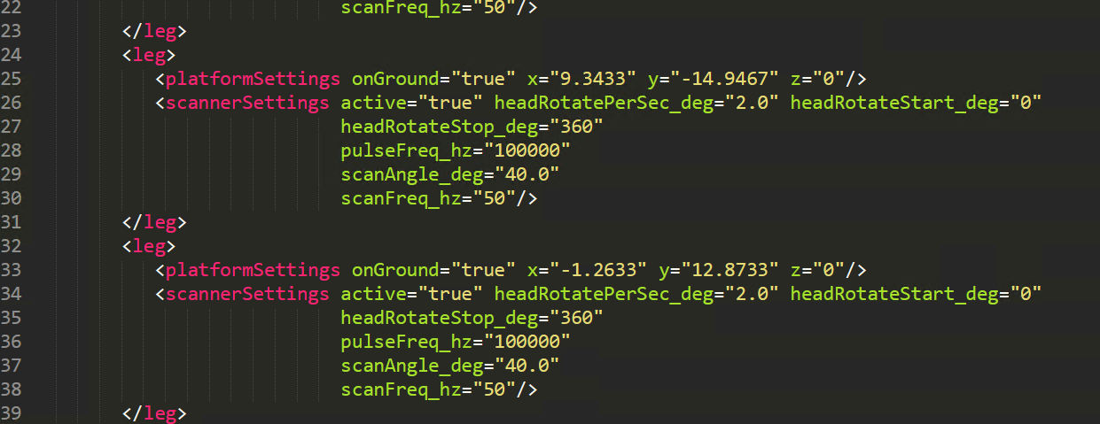
Relevant section of FWF.md for reference:
image

Cheers

Setting vertical field of view VZ-400

Hello and thanks for the great work!

I was wondering how I can define the vertical field of view for the Riegl VZ-400 in HELIOS using a levelled scanner. For the horizontal field of view this is possible with "headRotateStart_deg" and "headRotateStop_deg". If doing the same for the vertical field of view the I only get a narrow strip which does not correspond to the desired absolute vertical field of view (e.g. absolute FOV = 30°, starting at -5° and ending at +25°).

Best regards

adding attributes to the points

Is it possible to add the attribute or material of the surface to the point clouds? For example, if the ray is hitting a tree surface, in the point cloud, we save the label as a tree. If you guide me to the correct place in the code I can work on it.

Documentation of scan settings

Is there a description of the scan settings?
Is it possible to create a description to this settings on github? (User view)

About simulating a helicopter

We are working on a similar project that we are attending to use your open source, we tried to simulate helicopter in the code but we didn't succeed can you please help us in that where to call the helicopter class .

thanks,

Use of scan angle

What influence does the Scan Angle has?
Where in the simulation is it used?
Is it the angle range of the defractor?
Is there a relation between Scan Angle and the highlighted ScanRange in the scanner visualization (lightblue)?

Some questions about the resolution

Hello and thanks for the great work!

I try to set the same resolution in the vertical and horizontal way to commit a scanning, the horizontal resolution comes up to my expectation. However the result shows that the vertical resolution is lower than it should be. I was wondering that is there any difference between the definition of the vertical and horizontal resolution?
In addition, I try to set the horizontal resolution in the ALS mode by the formula "horizontal resolution = headRotatePerSec_deg / scanFreq_hz", but I found that when I change the " headRotatePerSec_deg" , the resolution wouldn't change at all. Is this parameter fixed? BTW, I use the scanner "riegl_lms-q780" for the testing.

Best regards

installation

Hello,
I'm hoping to use Helios to help me plan UAV lidar. I'm having issues building Helios. I have added the Java Build Path for jre1.8.0_31. I also managed to add lemur-1.9.1.jar using Add External JARs...The Java Compiler compliance level is set to 1.8. However, lidar is not recognized when I search for it in run as java application. I'm not certain where I've gone wrong. Also, the library folder seems to be missing from the github download. I ended up copying it from the pre-compiled folder. Thanks very much for your help

Set up vertical scanning in ALS

Because of some research needs, I want to try vertical scanning In ALS data simulation.But I can't find any instructions about this even in Helios++.Is there no such function?
Thanks!

BeamDeflector: Meaning and use of lastPulseLeftDevice()

Hey,
I try to understand the BeamDeflector classes.
In the simulation is a function lastPulseLeftDevice() used. What is the use of this function?

I found one point in the simulation of the scanner.
https://github.com/GIScience/helios/blob/master/src/main/java/de/uni_hd/giscience/helios/core/scanner/Scanner.java#L79

This point is a break condition for the beam simulation. But for the most BeamDeflectors this function is TRUE, or has conditions which do not get to FALSE.
https://github.com/GIScience/helios/blob/master/src/main/java/de/uni_hd/giscience/helios/core/scanner/beamDeflector/PolygonMirrorBeamDeflector.java#L42

Can we remove unused behavior?

Thanks for your help.

problems about ground and tree model color

Hi there,

I'm interested in ALS data simulation. Helios is quite good and it can meet nearly all my needs. However, i encountered with some problems when simulating ALS data with Helios.
Firstly, I follow the Wiki instruction to generate .mtl files with blender and try to import .obj models into Helios. However, only one tree was successfully merged with color information and this problem also shown in importing DEM to Helios.(please refer to figure 1 and figure 2)
Secondly, There is no ground information in simulated data after replacing the default groundplane with other DEM .obj file(please refer to figure 2)

Could you please tell me how to fix this?

Figure1:
image

Figure2:
image

Two scanners

Hello, how do I add two scanners on one platform? I wish to simulate RIEGL VMX-45 mobile laser scanning system, which equips with two RIEGL VQ-450 scanners. Many thanks. Best Regards.

Is there a program for generating 3D crop triangle mesh models?

Hi,
I deeply read the paper about HELIOS (Bechtold, et al., 2016) and found an interesting point, at least for me, that you might develop a program for generating 3D triangle mesh models of crop fields.

Page 8: In order to show possibilities for the use of HELIOS in this field of research, a “proof of concept” experiment to simulate laser scanning of a virtual crop field was performed. As a first step,
a program which can generate 3D triangle mesh models of crop fields was developed. The program produces crop field models in the Wavefront object (.OBJ) file format, based on a number of parameters like distance between plants in a row, distance between plant rows, plant height, number of leaves, and others. Average values for these parameters are entered by the user, and the program adds random variations to produce more realistic results.

Close-up view of a procedurally generated crop field model

I sincerely hope to use this amazing tool for creating my own crop scene. Could you provide more detailed information about this program, such as papers and codes, if possible. Thank you in advance.

Linyuan

Could the author provide an illustration picture for scanner settings?

Hi,
I come here from DART LiDAR module because the DART requires much too high performance of computer and takes a lot of time for simulating TLS measurement of forest sample plot with 0.036 degree resolution.

Really nice job, the HELIOS. Perfectly fit my need. Less parameters and faster simulation as well as visualization. But the only one I could say is the lack of illustration of scanner parameters and scene parameters, such as scan angle, pulse frequency , scan frequency , yaw, pitch and roll.

  • scan angle: is the range of scan angle is 0~90 degrees? I saw you said that it is defined as the half of FOV in zenith direction, e.g., if scan angle = 90, the FOV will be 180 degrees, implying measurement from downward to upward?
  • pitch : the default value is 90 degrees. Are the yaw, pitch and roll of tree model consistent with those of airplane? I tested yaw and found its meaningful range is 0~90. Might be not. Could you explain a little?

Can not generate scene

Hello all,

Would be grateful if you might help me...

I obtained an .obj file from .dae in blender (before, it worked nicely with multiple formats) and tried to visualize it in helios for lidar simulation. But the problem is that the script can not generate a scene file, giving ---> see below --->
cap1
cap2

Let me know if you have any ideas,
Best,
Anton

ULS simulated

 In using HELIOS, I encountered the following questions:
  1. When I simulated the ULS data using the platform of quadcopter and RIEGL VUX-1UAV scanner, scanning stopped after the flight of the first scanning line, but using the platform sr22 can scan all 6 airlines. Why?
    (Attachment is my xml file)
    2.The beam origin of the scanner "RIEGL VUX-1UAV" is the same as "Optech ALTM 2033"? And what does the "beam origin" mean?
    3.How is the platform's coordinate system and where is the 0° of the sensor scanning angle? As my first scanning line output, it had only a little points, from the Jmonkey simulator, I found the emitted laser can hardly hit the ground.

Import/export of KD-Tree

For large datasets the building of the KD-tree takes large parts of the total runtime. Several use cases exist where a re-use of the KD-Tree is possible. You build it only once and can re-use it inother simulations as scene input (e.g. reading it direclty from a binary compressed image on disk). This issue requests for an input/export option for the KD-tree.

A contribution for automatic generation of forest scene (MATLAB script)

Hi,
I come again.
In this post, I'd like to provide several MATLAB scripts for automatically generating various forest scenarios. These scripts were motivated by my need of TLS simulations for many forest plots. Generally, we need a forest plot with many different trees (look like more realistic). Hence, we can modify the scale, position and rotation of tree models. The function of these scripts is to do so.

An example of forest plot

Download it!

But, there might be a bug I need to report. Not worry. Not a bug of matlab script, it's about HELIOS. I make sure that the generated XML file of tls survey is correct after inspection. However, when I run the HELIOS, some of tls scans were located at the top of forest canopy. Really strange. Could someone tell me why this happened?
the tls scan position is correct

Linyuan Li

Introduce HELIOS platform and workflow in Chinese for extending impact

Dear the authors and maintainers of HELIOS,

Hi.
I summarized the features, basic principles and usage workflows of HELIOS in Chinese language, to extend the impact of HELIOS, as it is a so powerful and useful application. I'd like to put the web link of the Chinese blogs (博客园) here, if you don't mind, for the convenience of Chinese researchers and users.

If it's not proper to post here, please tell me. Thank you for your understanding in advance.

Linyuan Li

Documentation of Scanner XML elements

Is it possible to create a description of the scanner and its representation in the scanner XML?
What are the different XML elements and which influence does they have in the simulation?
Maybe with a example scanner.

Simulation seems very slow/Disable Full-wave?

Hi,
I am using precompiled Helios. It seems extremely slow on my machine (small scene with only 5 cars, .scene file is around 50MB, taking one scan with Riegl VZ400). I am using a quad-core laptop with i5-7300HQ and graphics card. Scanning only 90 degree roughly takes up to 40 minutes (GUI) or around 10 minutes (headless). Both ways produce 100% cpu load on all cores.

Is this normal behavior?

Maybe there is a way to speed it up? For instance I do not need full-wave information. Can I disable this feature?
I tried lowering <FWFSettings numFullwaveBins="..." /> in the surveys xml. But :
0 -> Error
small number -> "Broke after ... iterations" appears very often
Also that doesn't seem to speed up the process.

Hope you can help. I wrote a converter from Blender to Helios for my research and want to process some bigger scenes.

Thanks

Progress bar while simulation is running

In large scenes, the simulation may run for hours and days and it is difficult to assess the overall runtime.

Subsequently, both in the GUI and in headless mode, it would be much appreciated to get information about the past runtime, the runtime to go, and the percentage of progress. In best case all of this for each individual leg and for the overall simulation.

issue about a moving object

hello, thank you for your great job! I am wondering if the HELIOS can simulate the moving object. How to add a moving object and get the point cloud of this moving object?

`mvn package` could not resolve dependencies

[WARNING] The POM for org.geotools:gt-geotiff:jar:13.0 is missing, no dependency information available
...
[WARNING] The POM for org.geotools:gt-image:jar:13.0 is missing, no dependency information available
...
[WARNING] The POM for org.geotools:gt-referencing:jar:13.0 is missing, no dependency information available
...
[WARNING] The POM for org.geotools:gt-epsg-hsql:jar:13.0 is missing, no dependency information available
...
[WARNING] The POM for org.geotools:gt-epsg-extension:jar:13.0 is missing, no dependency information available
...
[WARNING] The POM for org.geotools:gt-wms:jar:13.0 is missing, no dependency information available
[INFO] ------------------------------------------------------------------------
[INFO] BUILD FAILURE
[INFO] ------------------------------------------------------------------------
[INFO] Total time:  29.839 s
[INFO] Finished at: 2020-04-15T19:19:28+02:00
[INFO] ------------------------------------------------------------------------
[ERROR] Failed to execute goal on project helios: Could not resolve dependencies for project de.uni-hd.giscience:helios:jar:0.0.1: The following artifacts could not be resolved: org.geotools:gt-geotiff:jar:13.0, org.geotools:gt-image:jar:13.0, org.geotools:gt-referencing:jar:13.0, org.geotools:gt-epsg-hsql:jar:13.0, org.geotools:gt-epsg-extension:jar:13.0, org.geotools:gt-wms:jar:13.0: Could not find artifact org.geotools:gt-geotiff:jar:13.0 in osgeo (http://download.osgeo.org/webdav/geotools/) -> [Help 1]
[ERROR] 
[ERROR] To see the full stack trace of the errors, re-run Maven with the -e switch.
[ERROR] Re-run Maven using the -X switch to enable full debug logging.
[ERROR] 
[ERROR] For more information about the errors and possible solutions, please read the following articles:
[ERROR] [Help 1] http://cwiki.apache.org/confluence/display/MAVEN/DependencyResolutionException

The requested url http://download.osgeo.org/webdav/geotools/ is no longer available.
Since I am new to the project and Maven I am not really sure what kind of files to look for?
The (former?) structure of the download server can be found here: https://wiki.osgeo.org/wiki/Download_Server

Recommend Projects

  • React photo React

    A declarative, efficient, and flexible JavaScript library for building user interfaces.

  • Vue.js photo Vue.js

    🖖 Vue.js is a progressive, incrementally-adoptable JavaScript framework for building UI on the web.

  • Typescript photo Typescript

    TypeScript is a superset of JavaScript that compiles to clean JavaScript output.

  • TensorFlow photo TensorFlow

    An Open Source Machine Learning Framework for Everyone

  • Django photo Django

    The Web framework for perfectionists with deadlines.

  • D3 photo D3

    Bring data to life with SVG, Canvas and HTML. 📊📈🎉

Recommend Topics

  • javascript

    JavaScript (JS) is a lightweight interpreted programming language with first-class functions.

  • web

    Some thing interesting about web. New door for the world.

  • server

    A server is a program made to process requests and deliver data to clients.

  • Machine learning

    Machine learning is a way of modeling and interpreting data that allows a piece of software to respond intelligently.

  • Game

    Some thing interesting about game, make everyone happy.

Recommend Org

  • Facebook photo Facebook

    We are working to build community through open source technology. NB: members must have two-factor auth.

  • Microsoft photo Microsoft

    Open source projects and samples from Microsoft.

  • Google photo Google

    Google ❤️ Open Source for everyone.

  • D3 photo D3

    Data-Driven Documents codes.