melihaltintas / vue3-openlayers Goto Github PK
View Code? Open in Web Editor NEWWeb map Vue 3.x components with the power of OpenLayers
Home Page: https://vue3openlayers.netlify.app/
License: MIT License
Web map Vue 3.x components with the power of OpenLayers
Home Page: https://vue3openlayers.netlify.app/
License: MIT License


in the following example, I get this error when trying to modify a feature from my geojson object. Using the recently added modify & snap interactions components.
Maximum recursive updates exceeded. This means you have a reactive effect that is mutating its own dependencies and thus recursively triggering itself. Possible sources include component template, render function, updated hook or watcher source function.
I have tried using reactive, refs, manually creation polygon/features instead of geojson, always end up with the same issue.
Here is the template if you want to test it, I get errors trying to setup a codesandbox using vue3-openlayers.
One thing I noticed is when I use a url to load geojson data, there is no error during the modification. Only when I use my own geojson object, does it show the error.
I have added both options (url and my geojson object you can alternate between both)
<template>
  <ol-map ref="map" :load-tiles-while-animating="true" :load-tiles-while-interacting="true" style="height: 400px">
    <ol-view ref="view" :center="center" :rotation="rotation" :zoom="zoom" :projection="projection" />

    <ol-tile-layer>
      <ol-source-osm />
    </ol-tile-layer>

    <ol-vector-layer :style="vectorStyle">
      <ol-source-vector :features="zones">
        <!-- <ol-source-vector :url="'https://openlayers.org/en/latest/examples/data/geojson/countries.geojson'" :format="geoJsonFormat"> -->
        <ol-interaction-modify v-if="modifyEnabled"> </ol-interaction-modify>
        <ol-interaction-snap v-if="modifyEnabled" />
      </ol-source-vector>
    </ol-vector-layer>
    <ol-interaction-select @select="featureSelected" :condition="selectCondition">
      <ol-style>
        <ol-style-stroke :color="'red'" :width="2"></ol-style-stroke>
        <ol-style-fill :color="`rgba(255, 0, 0, 0.4)`"></ol-style-fill>
      </ol-style>
    </ol-interaction-select>
  </ol-map>
</template>

<script>
import { reactive, ref, inject } from 'vue'
import { GeoJSON } from 'ol/format'
import { Fill, Stroke, Style, Text } from 'ol/style'

export default {
  setup() {
    const center = ref([-102.13121, 40.2436])
    const projection = ref('EPSG:4326')
    const zoom = ref(5)
    const rotation = ref(0)
    const modifyEnabled = ref(false)

    const geojsonObject = {
      type: 'FeatureCollection',
      crs: {
        type: 'name',
        properties: {
          name: 'EPSG:4326'
        }
      },
      features: [
        {
          type: 'Feature',
          geometry: {
            type: 'Polygon',
            coordinates: [
              [
                [-103.86923852630616, 43.45599322423934],
                [-103.90891107984544, 39.34240191087722],
                [-98.76630637117387, 39.558687199211114],
                [-98.89435771175386, 43.945405844902986],
                [-103.86923852630616, 43.45599322423934]
              ]
            ]
          }
        },
        {
          type: 'Feature',
          geometry: {
            type: 'Polygon',
            coordinates: [
              [
                [-103.85636392303468, 38.10970692739486],
                [-103.86770698495866, 33.218572724914544],
                [-98.20654544301988, 33.6532810221672],
                [-98.4408283538437, 38.31894739375114],
                [-103.85636392303468, 38.10970692739486]
              ]
            ]
          }
        },
      ]
    }

    const zones = ref([])

    zones.value = new GeoJSON().readFeatures(geojsonObject)

    function vectorStyle() {
      const style = new Style({
        stroke: new Stroke({
          color: 'blue',
          width: 3
        }),
        fill: new Fill({
          color: 'rgba(0, 0, 255, 0.4)'
        })
      })
      return style
    }

    const geoJsonFormat = new GeoJSON()
    const selectConditions = inject('ol-selectconditions')
    const selectCondition = selectConditions.click

    function featureSelected(event) {
      if (event.selected.length > 0) {
        modifyEnabled.value = true
      }
      if (event.deselected.length > 0) {
        modifyEnabled.value = false
      }
    }

    return {
      vectorStyle,
      geoJsonFormat,
      featureSelected,
      selectCondition,
      zones,
      center,
      projection,
      zoom,
      rotation,
      modifyEnabled
    }
  }
}
</script>
Is your feature request related to a problem? Please describe.
I'm not sure. I tried to find an example where I can assign individual styles to geo-points regarding some attribute of those points (say you have a map with geo-points and they are color-coded depending if there's an issue in such place), but if they're inside an animated clusterlayer the layer style is defining the style, but the geo point doesn't seem to be able to get it individually.
Describe the solution you'd like
Doing it this way doesn't work:
It will take the styles of the animation layer, but if I remove it and leave only the style in the feature, it won't take any style at all.
<ol-animated-clusterlayer :animationDuration="500" :distance="40">
        <ol-source-vector ref="vectorsource">
          <ol-feature v-for="site in geopoints" :properties="{name: site.name}">
            <ol-geom-point
                :coordinates="fromLonLat(site.coordinates, projection.value)"
            ></ol-geom-point>
            <ol-style v-if="site.id == 8">
              <ol-style-circle :radius="radius">
                <ol-style-fill :color="fillColor"></ol-style-fill>
                <ol-style-stroke :color="strokeColor" :width="strokeWidth"></ol-style-stroke>
              </ol-style-circle>
            </ol-style>
          </ol-feature>
        </ol-source-vector>

        <ol-style :overrideStyleFunction="overrideStyleFunction">
          <ol-style-stroke color="red" :width="2"></ol-style-stroke>
          <ol-style-fill color="rgba(255,255,255,0.1)"></ol-style-fill>

          <ol-style-circle :radius="20">
              <ol-style-stroke color="rgba(255,255,255,0.1)" :width="15" :lineDash="[]" lineCap="butt"></ol-style-stroke>
              <ol-style-fill color="rgba(255,255,255,0.5)"></ol-style-fill>
          </ol-style-circle>

          <ol-style-text>
              <ol-style-fill color="white"></ol-style-fill>
          </ol-style-text>
        </ol-style>
      </ol-animated-clusterlayer>
Is your feature request related to a problem? Please describe.
Managing features easily so we can export them in a classic es6 object format to store in database and reuse later
This is basically abstracting OL
we can expand this to a complete object of the map state
Would be super useful for beginners
Describe the solution you'd like
something like
this.$ref.map.getFeatures()
this.$ref.map.removeFeatures()
this.$ref.map.addFeatures()
this.$ref.map.setFeatures()
this.$ref.map.getState()
this.$ref.map.setState()
Describe the bug
Loading my component I get the following error : TypeError: undefined is not an object (evaluating 'val.toLowerCase')
[Vue warn]: Failed to resolve async component: function MapData() { return Promise.all(/*! import() */[__webpack_require__.e("defaultVendors-node_modules_vue3-openlayers_dist_vue3-openlayers_common_js"), __webpack_require__.e("defaultVendors-node_modules_ol_Object_js-node_modules_ol_has_js-node_modules_ol_proj_js"), __webpack_require__.e("defaultVendors-node_modules_vue3-openlayers_dist_vue3-openlayers_css-node_modules_ol_style_Style_js"), __webpack_require__.e("default-src_vue_component_map_map-data_vue-data_image_png_base64_iVBORw0KGgoAAAANSUhEUgAAABIA-d8f71b")]).then(__webpack_require__.bind(__webpack_require__, /*! ../map/map-data.vue */ "./src/vue/component/map/map-data.vue"));
To Reproduce
I just installed vue3-OpenLayers in my project
Expected behavior
no error message
Desktop (please complete the following information):
Additional context
I just installed vue3-OpenLayers in my project
using webpack 5
here is my component:
gist
How can I unselect a feature programmatically?
Hi ,
I want to load a map from geoserver. I config the tile cache in geoserver and i can get tile image from browser .
http://localhost:28080/geoserver/gwc/service/wmts/rest/test_site:south_sea_release/default/EPSG:4326/EPSG:4326:7/46/200?format=image/png
I use ol-source-wmts to load the tile image:
<ol-tile-layer :zIndex="1001" :center="center">
      <ol-source-wmts
          :url="url"
          :matrixSet="matrixSet"
          :format="format"
          :style="styleName"
          :projection="projection"
          requestEncoding="REST"
      >
      </ol-source-wmts>
    </ol-tile-layer>
    const url = ref('http://localhost:28080/geoserver/gwc/service/wmts/rest/test_site:south_sea_release/{style}/{TileMatrixSet}/{TileMatrix}/{TileRow}/{TileCol}?format=image/png')
    const layerName = ref('test_site:south_sea_release')
    const matrixSet = ref('EPSG:4326')
    const format = ref('image/png')
    const styleName = ref('default')
I found some error in browser console and the actual request is:
http://localhost:28080/geoserver/gwc/service/wmts/rest/test_site:south_sea_release/default/EPSG:4326/3/2/6?format=image/png
I found the source code to compute matrixIds are
     const getTileGrid = computed(() => {

            const resolutions = new Array(14);
            const matrixIds = new Array(14);

            for (var z = 0; z < 14; ++z) {

                resolutions[z] = size.value / Math.pow(2, z);
                matrixIds[z] = z;
            }

            return new WMTSTileGrid({
                origin:origin.value,
                resolutions,
                matrixIds
            });
        });
So i want to know how to add the prefix (e.g. EPSG:4326 in this question).
I'm a beginner to use openlayer and geoserver and not sure if this can be configed in geoserver.
Thanks a lot.
Jeffry
would be nice to be able to hide Vector layers like drawings from ol-layerswitcherimage-control menu (vectors still displayed of course)
at the moment the menu always shows this extra layer even if no drawings are present
something like
<ol-layerswitcherimage-control :vectorLayers="false" />
Describe alternatives you've considered
removing manually with ol functions but that seems terribly wrong to instantiate something just to remove it
When implement ol-interaction-draw how i can add feature to user delete the selected shape ,
i'm try from ol-interaction-clusterselect get the featureSelected event and if have a function to delete the current element or something like that or please if have some other way.
Thank you.
https://github.com/mapgears/ol3-google-maps offers the option to use Google Maps (with the api key) with OpenLayers.
Now my question is would it be possible to create a source that uses olgm for this project. Or a custom source that uses Google Maps (with the api key)?
Here is a quick example https://codesandbox.io/s/vue3-openlayers-forked-v3478?file=/src/App.vue
I have been scouring the doc and internet for options on how to disable all user interactions with the map.
Only reference I could find in doc is view.value.getInteracting()) but this return false
How can this return false when I am clearly interacting with the map ?
then I decided to try something else like suggested on SO but getInteractions() is undefined
this code successfully disables dragpan but with error undefined is not an object (evaluating 'interaction.constructor')
  olMap.value.map.getInteractions().forEach(function(interaction) {
    if (interaction.constructor.name === 'DragPan') {
      olMap.value.map.removeInteraction(interaction);
    }
  }, context);
Before Vue3-openLayers I used to use a Vue2 one called ghettovoice/openlayers and I could just set interactions with a prop on the ol-map component like this:
:default-interactions="interactionOptions"
interactionOptions: {
dragPan: true, // disable move by drag
onFocusOnly:false,
mouseWheelZoom:true,
shiftDragZoom:true,
altShiftDragRotate:true,
doubleClickZoom:true,
keyboard:true,
pinchRotate:true,
pinchZoom:true,
zoomDelta:1,
zoomDuration:1000
},
I added custom ol-control-toggle
<ol-control-toggle v-if="selectedFeatures && selectedFeatures.array_ && selectedFeatures.array_.length > 0" html="<i class='fas fa-trash'></i>" className="edit" title="bin" :onToggle="(active)=>deleteSelectedFeature()" />
v-if is default false
All controls are duplicated when v-if becomes true
I cannot see in the doc an example of a multicolor linestring
the closest I fount is the multi-line-string so I tried this
      <ol-feature v-if="waypoints && waypoints.length > 0">
        <ol-geom-multi-line-string :coordinates="waypoints"></ol-geom-multi-line-string>
        <ol-style :overrideStyleFunction="overrideStyleFunction">
          <ol-style-stroke color="green" :width="7"></ol-style-stroke>
        </ol-style>
      </ol-feature>
problem is that my overrideStyleFunction is only triggered once and the line is the same color everywhere
not sure what I am doing wrong
OL has Flowline which could be great to have as a component ?
i need use openlayers api ,how to get Map and View ?
now,i use ref
map = olMapRef.value.map as Map; view = olViewRef.value.view as View;
Is there a better way?
How to set properties for "feature"?
Is there some method to setting "properties" to "feature", like:
<ol-source-cluster :distance="40">
    <ol-source-vector>
        <ol-feature
            v-for="{id, coordinates} in markers"
            :key="id"
            @click="clickFeature"
            @setProperties="setProperties(id)">
            <ol-geom-point :coordinates="coordinates"/>

            <ol-interaction-modify
                :condition="selectCondition"
                @modifyend="modifyEnd($event, id)"
                @modifystart="modifyStart">
            </ol-interaction-modify>
        </ol-feature>

        <ol-interaction-select @select="featureSelectedTwo($event, id)">
        </ol-interaction-select>
    </ol-source-vector>
</ol-source-cluster>
or how I can provide properies and handle them?
Dear Melih,
It seems to be a good improvement to provide a way to register new projection.
Only EPSG:3857 and EPSG:4326 are included in openlayers 6,
Creating a projection with ol.proj.Projection(…) is not sufficient because there is so much parameters.
For example in France we use RGF93 (epsg:2154) coordinates so we need to define:
//Proj4 initialization
import proj4 from 'proj4';
import {register} from 'ol/proj/proj4';
proj4.defs("EPSG:2154", "+proj=lcc +lat_1=49 +lat_2=44 +lat_0=46.5 +lon_0=3 +x_0=700000 +y_0=6600000 +ellps=GRS80 +towgs84=0,0,0,0,0,0,0 +units=m +no_defs");
register(proj4);
//if needed
const epsg2154_fullextent = [-357823.2365, 6037008.6939, 1313632.3628, 7230727.3772];
Thanks for your work !
Awesome project you got going on here and very good job.
If I could suggest some components, it would definitely be the draw, modify and snap interactions. Those would be awesome to have.
Describe the bug
Map fails to process 'white' tiles if user loses connection mid usage.
To Reproduce
Steps to reproduce the behavior:
Expected behavior
White tiles should initiate new call for source img.
Can't reproduce bugs on official openlayers examples.
Screenshots
Desktop (please complete the following information):
Hello there,
Thank you for your awesome library!
I'm not sure whether or not it's the right place to ask for help (maybe it could be relevant to enable the "Discussions" feature on that repository?) but I have a few questions that documentation doesn't answer me.
First of all, on all examples, the maps look "squashed". After further investigation using the EPSG:4326 projection seems to be the guilty, as using the default one fixes it. But then, the whole coordinates system is f*cked up, as you have to translate all coordinates to EPSG:3857, which is really annoying. Is it the right thing to do or did I miss something?

Secondly, I managed to draw a circle on the map, but for my use case, I wish that starting to draw a second circle removes the 1st one. Do you have any clue on how to achieve this?
Lastly, when you want to show a circle on the map as described here, zooming in or out doesn't change the size of the circle, which (in my use case of outlining geographical areas) should scale with the zoom, but it remains fixed. I didn't figure out how to handle this, except converting the circle to a polygon then displaying it this way, but that's really overkill / uncomfy. Any ideas?
Thanks!
Ben
Is your feature request related to a problem? Please describe.
Using interactions are super difficult to learn - it does not make sence to use another component, wire it by callback and properties to just make onClick on an geometry. Or specifically, it makes sence only to devs who have OL internals in mind. ;-)
Describe the solution you'd like
Offer set of events, props on geometries or featues itself as it is usual in Vue ecosystem.
<ol-view @click="hoverPlace = false">
...
        <ol-feature v-for="place in places" @hover="hoverPlace = place.id" @click="selectedPlace(place.id)">
          <ol-geom-point :coordinates="fromLonLat(place.lonLat)" />
          <ol-style :z-index="place.type === 'ln_verified' ? 10 : 1">
            <ol-style-icon src="assets/ln_marker.svg" :scale="hoverPlace === place.id ? 0.1 : 0.05" />
          </ol-style>
        </ol-feature>
...
selectedPlace (place) {
  $router.push('/place/' + place)
}
Example form Mapbox: https://v-mapbox.geospoc.io/api/marker.html#events
Describe alternatives you've considered
Use any other library what offers simpler aproach in Vue - used Leaflet and MapboxJS, both are easy to use.
in the following example using the draw interaction with the my generated features. If I draw a polygon and then click on another polygon to select it and modify it, the drawn one disappears because the source changes.
However when using the :url features if you draw a polygon and then select a country and modify it, the drawn polygon doesn't disappear.
So if I understand correctly, if I want the source to remain the same I must use the :url instead of :features parameter to load features?
Also the stopClick on the parameter on the draw interaction doesn't seem to work, it still fires the click event.
https://codesandbox.io/s/vue3-openlayers-forked-qqrqx?file=/src/App.vue:807-816
Reproduction link
Steps to reproduce
   function loadEvent(resumeData = null) {
      createApp(eventMainComponent, {resumeData: resumeData}).use(OpenLayersMap).mount("#Vue-events")
    }
What is expected?
Component uses OpenLayersMap
What is actually happening?
Not sure if this is related to OpenLayers or Vue3-OpenLayers or simply Vue3
problem is OpenLayersMap not found inside the created app on a reload
in the sandbox you see the map disappear on reload
My application is not a full vue application
my menu loads vue instances in the website dynamically
for example I click on Events and this will trigger the following code:
    import OpenLayersMap from 'vue3-openlayers'
    createApp(eventMainComponent,{resumeData:resumeData}).use(OpenLayersMap).mount("#Vue-events")
works like a charm the first time but I switch to another page lets say blog
then if I reload Events that will execute the same code above I get
[Vue warn]: injection "ol-format" not found. which refers to const format = inject('ol-format');
Describe the bug
Upgrade to latest version of 0.1.39, and couldn't find any information about using DragRotateAndZoom interaction of map
To Reproduce
Just run npm run serve in project directory, then use shift key and drag to rotate, the rotation of map never change
Expected behavior
Could change the rotation of map by shift+drag
getTileGrid in ol-source-wmts is a computed value ,but my project has a error 'Unknown TILEMATRIX' , i think if getTileGrid can be a prop
Hi, I'm trying to get your package to work with Nuxt 3.
I tried importing it in my nuxt.config.ts like this:
import { defineNuxtConfig } from 'nuxt3'

export default defineNuxtConfig({
    buildModules: [
        ['vue3-openlayers', '@pinia/nuxt', '@intlify/nuxt3', '@vueuse/core/nuxt']
    ],
    intlify: {
       // ...
},
    build: {
        // ...
    }
})
Which gives me this error on app startup
ERROR  Cannot start nuxt:  Cannot read property 'webpackJsonpvue3_openlayers' of undefined

  at module.exports.00ee (node_modules/vue3-openlayers/dist/vue3-openlayers.common.js:191:148)
  at node_modules/vue3-openlayers/dist/vue3-openlayers.common.js:203:9
  at g (node_modules/jiti/dist/jiti.js:1:55111)
  at requireModule (node_modules/@nuxt/kit/dist/index.mjs:86:26)
  at installModule (node_modules/@nuxt/kit/dist/index.mjs:1241:50)
  at initNuxt (node_modules/nuxt3/dist/index.mjs:905:11)
  at async load (node_modules/nuxi/dist/chunks/dev.mjs:6713:9)
  at async Object.invoke (node_modules/nuxi/dist/chunks/dev.mjs:6752:5)
  at async _main (node_modules/nuxi/dist/chunks/index.mjs:386:7)
When I place the import at the end of the buildModules array, the error disappears, but upon opening my testpage I receive the following errors:
[Vue warn]: Failed to resolve component: ol-map
If this is a native custom element, make sure to exclude it from component resolution via compilerOptions.isCustomElement.
[Vue warn]: Failed to resolve component: ol-view
If this is a native custom element, make sure to exclude it from component resolution via compilerOptions.isCustomElement.
[Vue warn]: Failed to resolve component: ol-tile-layer
If this is a native custom element, make sure to exclude it from component resolution via compilerOptions.isCustomElement.
[Vue warn]: Failed to resolve component: ol-source-osm
If this is a native custom element, make sure to exclude it from component resolution via compilerOptions.isCustomElement.
Invalid value used as weak map key
  at WeakMap.set (<anonymous>)
  at normalizePropsOptions (./node_modules/vue/node_modules/@vue/runtime-core/dist/runtime-core.cjs.js:2689:11)
  at createComponentInstance (./node_modules/vue/node_modules/@vue/runtime-core/dist/runtime-core.cjs.js:6115:23)
  at renderComponentVNode (./node_modules/@vue/server-renderer/dist/server-renderer.cjs.js:197:22)
  at Module.ssrRenderComponent (./node_modules/@vue/server-renderer/dist/server-renderer.cjs.js:623:12)
  at _sfc_ssrRender (file://./.nuxt/dist/server/server.mjs:4813:31)
  at renderComponentSubTree (./node_modules/@vue/server-renderer/dist/server-renderer.cjs.js:263:13)
  at renderComponentVNode (./node_modules/@vue/server-renderer/dist/server-renderer.cjs.js:214:16)
  at renderVNode (./node_modules/@vue/server-renderer/dist/server-renderer.cjs.js:304:22)
  at renderVNode (./node_modules/@vue/server-renderer/dist/server-renderer.cjs.js:310:17)
Not sure if this is the right place to ask, but I'm stuck.
Thanks in advance!
When using an ol-source-vector with the KML data type, the component will not load, and prints this error:
runtime-core.esm-bundler.js:2143 Uncaught (in promise) DOMException: Failed to read the 'cssRules' property from 'CSSStyleSheet': Cannot access rules
    at traverse (http://localhost:8080/js/chunk-vendors.js:4620:27)
I've tried to create a standalone example, but in all my attempts the error doesn't happen. I only see it in my large quasar application, so possibly there's some interference there.
My broken Example:
<template>
  <ol-map
    ref="map"
    :loadTilesWhileAnimating="true"
    :loadTilesWhileInteracting="true"
    style="height:400px"
  >
    <ol-view
      ref="view"
      :center="center"
      :rotation="rotation"
      :zoom="zoom"
      :projection="projection"
    />

    <ol-fullscreen-control />

    <ol-zoom-control />

    <ol-tile-layer>
      <ol-source-osm />
    </ol-tile-layer>

    <ol-vector-layer>
      <ol-source-vector :url="url" :format="kml"> </ol-source-vector>
    </ol-vector-layer>
  </ol-map>
</template>

<script lang="ts">
import { defineComponent, ref, inject } from "vue";

export default defineComponent({
  name: "Map",
  components: {},
  props: {
    kmlData: { type: Object as any }
  },
  setup() {
    const center = ref([-81.51214560283877, 41.07716717533248]);
    const projection = ref("EPSG:4326");
    const zoom = ref(10);
    const rotation = ref(0);

    const url = ref("https://openlayers.org/en/latest/examples/data/kml/2012_Earthquakes_Mag5.kml");
    const format: any = inject("ol-format");
    const kml = new format.KML();

    return {
      center,
      projection,
      zoom,
      rotation,
      kml,
      url
    };
  }
});
</script>
I did get it working though! I had to add some extra settings to my KML config::
const kml = new format.KML({
  extractStyles: false,
  defaultStyle: []
});
This issue is mostly in case someone else has the same problem. Please feel free to close.
I get this error when passing the filter prop on ol-interaction-select component.
Extraneous non-props attributes (filter) were passed to component but could not be automatically inherited because component renders fragment or text root nodes.
<ol-interaction-select @select="featureSelected" :condition="data.selectCondition" :filter="filterFunc"></ol-interaction-select>
Hey all!
Thanks for providing this library, it makes our work with Vue and OL a lot easier!
But - is there any reason that you don't support the TileGrid for SourceXYZ?
We need it for our project and I've already included it in a local version, but it would be cool if you could provide the support officially as well. If you want, I can make a pull request with our local version. :)
Describe the bug
I detected an odd behavior when I tried to connect a state management system (vuex, pinia...):
Here is my view:
<ol-view ref="view" :center="center" :zoom="appStore.getMapZoomLevel()" @zoomChanged="zoomChanged" />
The only thing the store getter getMapZoomLevel() is just returning the value:
getMapZoomLevel() { return this.mapZoomLevel; },
And the action to set it:
setMapZoomLevel(zoomLevel) { this.mapZoomLevel = zoomLevel; },
I listen to the change event like such:
function zoomChanged(newzoom) { console.log(newzoom); appStore.setMapZoomLevel(newzoom); }
And I see non-integers numbers being dumped on the console and the scroll (using the mouse wheel) is veeery slow. It doesn't move by integers, that's what I mean.
You can reproduce it much simpler without state management system, just a reactive variable in zoom prop. Follow the steps in "To Reproduce" section:
To Reproduce
Steps to reproduce the behavior:
const zoom = ref(10) and use zoom in zoom prop (:zoom="zoom")@zoomChanged="zoomChanged"zoomChanged function: function zoomChanged(newzoom) { zoom.value = newzoom; }Expected behavior
As fast (or normal) as it behaves when there is no reactive variable being used.
Maybe I'm missing something, but with this behavior I wouldn't be able to share the zoom level on a global state and being able to zoom in and zoom out using external components by changing this value, which, I think, should be possible.
Am I missing something and doing it all wrong?
Thank you!
:)
How should I set up map tiles using my own server?
In the following example, when drawing, the snap interaction works only for the first drawn polygon. Or if you first select and modify one of the two polygons and then start drawing a polygon, the snap interaction doesn't work.
-However the snap interactions works on the modify interaction.
I am having a hard time figuring out how to automatically select / modify a polygon when I finish drawing it on the drawend event.
Adding the following to the drawend function doesn't quite work and I don't think I am doing it the right way.
selectedFeatures.value = event.feature
modifyEnabled.value = true
https://codesandbox.io/s/vue3-openlayers-forked-qqrqx?file=/src/App.vue
Under the development model, the work is normal, but in the production mode, an error is reported
vendor.1b452b69.js:1 Uncaught TypeError: Cannot read property 'refs' of null
at Pn (vendor.1b452b69.js:1)
at O (vendor.1b452b69.js:1)
at vendor.1b452b69.js:1
at n (vendor.1b452b69.js:1)
at Z (vendor.1b452b69.js:1)
at Y (vendor.1b452b69.js:1)
at z (vendor.1b452b69.js:1)
at U (vendor.1b452b69.js:1)
at O (vendor.1b452b69.js:1)
at vendor.1b452b69.js:1
Pn @ vendor.1b452b69.js:1
O @ vendor.1b452b69.js:1
(anonymous) @ vendor.1b452b69.js:1
n @ vendor.1b452b69.js:1
Z @ vendor.1b452b69.js:1
Y @ vendor.1b452b69.js:1
z @ vendor.1b452b69.js:1
U @ vendor.1b452b69.js:1
O @ vendor.1b452b69.js:1
(anonymous) @ vendor.1b452b69.js:1
n @ vendor.1b452b69.js:1
Z @ vendor.1b452b69.js:1
Y @ vendor.1b452b69.js:1
z @ vendor.1b452b69.js:1
U @ vendor.1b452b69.js:1
O @ vendor.1b452b69.js:1
(anonymous) @ vendor.1b452b69.js:1
n @ vendor.1b452b69.js:1
Z @ vendor.1b452b69.js:1
Y @ vendor.1b452b69.js:1
z @ vendor.1b452b69.js:1
U @ vendor.1b452b69.js:1
O @ vendor.1b452b69.js:1
st @ vendor.1b452b69.js:1
mount @ vendor.1b452b69.js:1
Yr.e.mount @ vendor.1b452b69.js:1
(anonymous) @ index.a10c460a.js:1
Now most vue3 projects no longer use webpack,In order to better adapt, do you consider using vite?
Describe the bug
Copying the ol-map sample fires this error
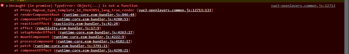
[Error] Unhandled Promise Rejection: TypeError: null is not an object (evaluating 'currentRenderingInstance.isCE')
	logError (runtime-core.esm-bundler.js:6664)
	handleError (runtime-core.esm-bundler.js:305)
	callWithErrorHandling (runtime-core.esm-bundler.js:259)
	flushJobs (runtime-core.esm-bundler.js:483)
	promiseReactionJob
To Reproduce
Steps to reproduce the behavior:
Expected behavior
Display a full width map and height 400px
package.json
{
  "name": "hello-openlayers",
  "version": "0.1.0",
  "private": true,
  "scripts": {
    "serve": "vue-cli-service serve",
    "build": "vue-cli-service build",
    "lint": "vue-cli-service lint"
  },
  "dependencies": {
    "@fortawesome/fontawesome-free": "5.15.3",
    "@popperjs/core": "2.9.1",
    "@tailwindcss/forms": "0.2.1",
    "@vue/compiler-sfc": "3.0.7",
    "chart.js": "2.9.4",
    "core-js": "3.9.1",
    "gulp": "4.0.2",
    "gulp-append-prepend": "1.0.8",
    "tailwindcss": "2.0.4",
    "vue": "3.0.7",
    "vue-router": "4.0.5",
    "vue3-openlayers": "^0.1.55"
  },
  "devDependencies": {
    "@babel/core": "7.13.10",
    "@babel/eslint-parser": "7.13.10",
    "@vue/cli-plugin-babel": "5.0.0-alpha.7",
    "@vue/cli-plugin-eslint": "5.0.0-alpha.7",
    "@vue/cli-service": "5.0.0-alpha.7",
    "autoprefixer": "10.2.5",
    "eslint": "7.22.0",
    "eslint-plugin-vue": "7.7.0",
    "postcss": "8.2.8",
    "vue-template-compiler": "2.6.12"
  },
  "eslintConfig": {
    "root": true,
    "env": {
      "node": true
    },
    "extends": [
      "plugin:vue/essential",
      "eslint:recommended"
    ],
    "rules": {},
    "parserOptions": {
      "parser": "@babel/eslint-parser"
    }
  },
  "postcss": {
    "plugins": {
      "autoprefixer": {}
    }
  },
  "browserslist": [
    "> 1%",
    "last 2 versions"
  ]
}
**Vue **
<template>
<ol-map :loadTilesWhileAnimating="true" :loadTilesWhileInteracting="true" style="height:400px">

    <ol-view ref="view" :center="center" :rotation="rotation" :zoom="zoom"
    :projection="projection" />

    <ol-tile-layer>
        <ol-source-osm />
    </ol-tile-layer>

</ol-map>
</template>
<script>
import {
    ref
} from 'vue'
export default {
    setup() {
        const center = ref([40, 40])
        const projection = ref('EPSG:4326')
        const zoom = ref(8)
        const rotation = ref(0)
        return {
            center,
            projection,
            zoom,
            rotation
        }
    },
}
</script>
main.js
import { createApp } from "vue";
import { createWebHistory, createRouter } from "vue-router";

// styles

import "@fortawesome/fontawesome-free/css/all.min.css";
import "@/assets/styles/tailwind.css";

// mouting point for the whole app

import App from "@/App.vue";

//vue3 openlayers
import OpenLayersMap from 'vue3-openlayers';
import 'vue3-openlayers/dist/vue3-openlayers.css';
import Test from "@/views/OpenLayers.vue";

// routes

const routes = [
  {
    path: "/",
    component: Test,
  },
  { path: "/:pathMatch(.*)*", redirect: "/" },
];

const router = createRouter({
  history: createWebHistory(),
  routes,
});

const app = createApp(App);

app.use(router);
app.use(OpenLayersMap);
app.mount("#app");
"vue3-openlayers": "0.1.*",
Hiding the map with v-show results in a blank canvas and error message [Warning] No map visible because the map container's width or height are 0. (vue-0eab179a9c5c1648c422.js, line 51744) when show = true
Not sure what to do about this; is this a bug or is there something to do ?
<ol-map
        ref="olMap"
        :key="uid+'-map'"
        class="ol-map-wrapper"
        :default-interactions="interactionOptions"
        style="height: 350px; width: 720px"
        v-on:mousedown="disableUpdate"
        v-on:mouseup="enableUpdate"
    >
calling olMap.value.map.updateSize() solves the visibility issue but I still have the warning
I could not find any documentation on this. If I missed it all my apologies for a useless post
I see that the demo has the exact same behavior; Did you forget props in demo ?
using the <ol-layerswitcherimage-control >
I have an extra layer with image data:image/png;base64, iVBORw0KGgoAAAANSUhEUgAAAEAAAABA … eJLjLwPul3vj5d0eAAAAAElFTkSuQmCC
then by default all my layers are selected; this is a big performance issue
Can you please let me know how to control this component ?
is it possible for you to add a the prop name to each of the layer types.
This will help with labeling and identifying layers.
Thanks!
I would like to suggest the features parameter for the Modify interaction.
Currently if a feature is selected to enable the Modify interaction, all the features present in an array would be added to the Modify features parameter.
if I understand correctly the features parameter on the Modify interaction allows to select which features can be modified.
In this example, if one country is selected to enable the editEnable, they would all be editable.
      <ol-vector-layer>
        <ol-source-vector :url="'https://openlayers.org/en/latest/examples/data/geojson/countries.geojson'" :format="geoJsonFormat" :projection="data.projection">
          <ol-interaction-modify v-if="editEnable" @modifyend="modifyend" @modifystart="modifystart"> </ol-interaction-modify>
          <ol-interaction-snap v-if="editEnable" />
        </ol-source-vector>
      </ol-vector-layer>
      <ol-interaction-select @select="featureSelected" :condition="selectCondition">
        <ol-style>
          <ol-style-stroke :color="'red'" :width="2"></ol-style-stroke>
          <ol-style-fill :color="`rgba(255, 0, 0, 0.4)`"></ol-style-fill>
        </ol-style>
      </ol-interaction-select>
EDIT:
If possible to add the features parameter on the Select Interaction as well.
Thank you for adding the props and for creating a codesandbox.
Trying them out on I get the following warning:
[Vue warn]: Invalid prop: type check failed for prop "features". Expected Collection, got Object
I don't quite understand because I am declaring the selectedFeature as a new Collection() and then when selecting a feature, it add's it to the collection array.
Here is the codesandbox:
https://codesandbox.io/s/vue3-openlayers-forked-jftt9?file=/src/App.vue
I have this very basic component below that gives me error:
Failed to resolve component: ol-view
I do not understand how to import vue3-openLayers properly. I used code from the official doc. It seems that the global imports are missing but I want to use in my component only. How do I import and reference inside my component.
The doc is not helping from what I can tell.
here is my full component
`
<ol-map :loadTilesWhileAnimating="true" :loadTilesWhileInteracting="true" style="height:400px">

<ol-view ref="view" :center="center" :rotation="rotation" :zoom="zoom"
         :projection="projection" />

<ol-tile-layer>
  <ol-source-osm />
</ol-tile-layer>

</ol-map>

</template>

<script>
import {ref} from 'vue'

export default {
setup() {
  const center = ref([40, 40])
  const projection = ref('EPSG:4326')
  const zoom = ref(8)
  const rotation = ref(0)
  return {
    center,
    projection,
    zoom,
    rotation
  }
  },
 }
 </script>`
Not really a bug but I need advice from the developpers because I am completely lost on the logic behind how to deal with feature states
the doc is not clear; at least for me.
I have this template
 <ol-interaction-select @select="featureSelected" :condition="selectCondition" :features="selectedFeatures">
    <ol-style>
      <ol-style-stroke :color="'red'" :width="2"></ol-style-stroke>
      <ol-style-fill :color="`rgba(255, 0, 0, 0.4)`"></ol-style-fill>
    </ol-style>
  </ol-interaction-select>
<ol-source-vector :projection="projection">
   <ol-interaction-modify v-if="modifyEnabled" :features="selectedFeatures" @modifyend="modifyend"></ol-interaction-modify>
   <ol-interaction-draw v-if="drawEnable" :type="drawType" @drawend="drawend"></ol-interaction-draw>
</ol-source-vector>
and the logic:
import {Collection} from "ol"
setup(){
       const selectedFeatures = ref(new Collection())
       let newFeatures = ref([])

       const drawend = (event) => {
          newFeatures.value.push({type:event.target.type_, coordinates:event.target.sketchCoords_})
          modifyEnabled.value = true
          drawEnable.value = false
          emit()
       }
       const modifyend = (event) => {
           // how to know which feature I am editing and how to get the new value ?
           emit()
        }
        function featureSelected(event) {
          const feature = event.target.getFeatures()
          selectedFeatures.value = event.target.getFeatures()
          if(feature.array_ && feature.array_.length) {
             let coordinates = null
             if(feature.array_[0].values_.geometries && feature.array_[0].values_.geometries.length) {
               coordinates = feature.array_[0].values_.geometries[0].flatCoordinates
             } else if(feature.array_[0].values_.geometry) {
               coordinates = feature.array_[0].values_.geometry.flatCoordinates
             }
            console.log(coordinates)
        }
    }
}
when I select I get the new coordinates with featureSelected but that seems cumbersome because I have to dig down into the object and there is no real relation between what I am editing and my data because newFeatures is not being updated.
selectedFeatures and newFeatures have different types so I need to translate one to the other and vice versa ?
Ideally everything should be sharing a single reactive value/format somewhere between the collection and the modified one but they are not linked/bridged ?? Ideally I would just like to put newFeatures in the modify component but I need to track selectedFeature instead and then copy values back to my newFeatures ?
In newFeatures I have a collection of simple data that has no reference to the dom like [{type:'Point',coordinates:[3,2,5]}]
in selectedFeatures I have a complex object so How am I supposed to keep references between both objects?
so I can get new values from console.log(coordinates) but what am I supposed to do with these ? How do I update my newFeatures array? is there no simple feature getter and setters ?
Clearly there must be something I am missing because I can't even extract feature type like LineString, circle, etc... from the modify event object.
in featureSelected I need to do selectedFeatures.value = event.target.getFeatures() and in drawend I have to do selectedFeatures.value.push(event.feature). What is the reason ?
or I could do without newFeatures if there is a way to get all current features from ol-interaction-draw component for export? but in which format to store in database so I can re-edit them later ?
Could you clarify for me? Sorry but I have been on this for 2 days now.
Full code https://gist.github.com/signmeuptwice/c45085e64e09828bc6f3bc81635fdb9e
ol-layerswitcherimage-control is frustrating
base layers should be displayed as radio to only have one selected at a time by default
From doc this is normally done by putting type='base' on the layer
We also need a user object to define custom groups
Describe the solution you'd like
props on the component
Use with vite error:
Please help me! Thank you!
Would be helpful to be able to easily change the drawing default blue Point to any color/shape.
Thank you.
Is your feature request related to a problem? Please describe.
A clear and concise description of what the problem is. Ex. I'm always frustrated when [...]
Describe the solution you'd like
A clear and concise description of what you want to happen.
openlayer 已经有 @types/ol ,但是 vue3-openlayers不能使用它
现在vue3-openlayers内是通过 provide , inject来获取。但是这样没有类型了
app.provide('ol-feature',feature)
app.provide('ol-geom',geom)
app.provide('ol-animations',animations)
app.provide('ol-format',format)
app.provide('ol-loadingstrategy',loadingstrategy)
app.provide('ol-selectconditions',selectconditions)
app.provide('ol-extent',extent)
我要怎么做才能在const selectConditions = inject('ol-selectconditions') 获取到selectConditions的类型呢
Describe alternatives you've considered
A clear and concise description of any alternative solutions or features you've considered.
Additional context
Add any other context or screenshots about the feature request here.
used the code from the vue3-openlayers example page https://vue3openlayers.github.io/demo/
I only changed path to png imports and imported import OpenLayersMap from 'vue3-openlayers'
I get error undefined is not an object (evaluating 'new format.GeoJSON')
of course if I download the repository and build the app from scratch it works but importing the plugin in my existing project fails
What am I doing wrong ?
here is my full code:
`
  <ol-view ref="view" :center="center" :rotation="rotation" :zoom="zoom" :projection="projection" />

  <ol-swipe-control ref="swipeControl" v-if="layerList.length > 0" :layerList="layerList" />

  <ol-layerswitcherimage-control />

  <ol-tile-layer ref="osmLayer" title="OSM">
    <ol-source-osm />
  </ol-tile-layer>

  <ol-tile-layer ref="jawgLayer" title ="JAWG">
    <ol-source-xyz crossOrigin='anonymous' url="https://c.tile.jawg.io/jawg-dark/{z}/{x}/{y}.png?access-token=87PWIbRaZAGNmYDjlYsLkeTVJpQeCfl2Y61mcHopxXqSdxXExoTLEv7dwqBwSWuJ" />
  </ol-tile-layer>

  <ol-control-bar>
    <ol-control-toggle html="<i class='fas fa-map-marker'></i>" className="edit" title="Point" :onToggle="(active)=>changeDrawType(active,'Point')" />
    <ol-control-toggle html="<i class='fas fa-draw-polygon'></i>" className="edit" title="Polygon" :onToggle="(active)=>changeDrawType(active,'Polygon')" />
    <ol-control-toggle html="<i class='fas fa-circle'></i>" className="edit" title="Circle" :onToggle="(active)=>changeDrawType(active,'Circle')" />
    <ol-control-toggle html="<i class='fas fa-grip-lines'></i>" className="edit" title="LineString" :onToggle="(active)=>changeDrawType(active,'LineString')" />
    <ol-control-videorecorder @stop="videoStopped">

    </ol-control-videorecorder>
    <ol-control-printdialog />
  </ol-control-bar>

  <ol-mouseposition-control />
  <ol-fullscreen-control />
  <ol-overviewmap-control>
    <ol-tile-layer>
      <ol-source-osm />
    </ol-tile-layer>
  </ol-overviewmap-control>

  <ol-scaleline-control />
  <ol-rotate-control />
  <ol-zoom-control />
  <ol-zoomslider-control />
  <ol-zoomtoextent-control :extent="[23.906,42.812,46.934,34.597]" tipLabel="Fit to Turkey" />

  <ol-context-menu :items="contextMenuItems" />

  <ol-interaction-clusterselect @select="featureSelected" :pointRadius="20">
    <ol-style>
      <ol-style-stroke color="green" :width="5"></ol-style-stroke>
      <ol-style-fill color="rgba(255,255,255,0.5)"></ol-style-fill>
      <ol-style-icon :src="markerIcon" :scale="0.05"></ol-style-icon>
    </ol-style>
  </ol-interaction-clusterselect>

  <ol-interaction-select @select="featureSelected" :condition="selectCondition" :filter="selectInteactionFilter" v-if="!drawEnable">
    <ol-style>
      <ol-style-stroke color="green" :width="10"></ol-style-stroke>
      <ol-style-fill color="rgba(255,255,255,0.5)"></ol-style-fill>
      <ol-style-icon :src="markerIcon" :scale="0.05"></ol-style-icon>
    </ol-style>
  </ol-interaction-select>


  <ol-vector-layer title="AIRPORTS" :preview="require('../../../../public/img/map/tr.png')">
    <ol-source-vector ref="cities" url="https://raw.githubusercontent.com/alpers/Turkey-Maps-GeoJSON/master/tr-cities-airports.json" :format="geoJson" :projection="projection" >

      <ol-interaction-modify v-if="drawEnable" @modifyend="modifyend" @modifystart="modifystart">

      </ol-interaction-modify>

      <ol-interaction-draw v-if="drawEnable" :type="drawType" @drawend="drawend" @drawstart="drawstart">

      </ol-interaction-draw>

      <ol-interaction-snap v-if="drawEnable" />

    </ol-source-vector>

    <ol-style>
      <ol-style-stroke color="red" :width="2"></ol-style-stroke>
      <ol-style-fill color="rgba(255,255,255,0.1)"></ol-style-fill>
      <ol-style-circle :radius="7">
        <ol-style-fill color="blue"></ol-style-fill>
      </ol-style-circle>
    </ol-style>
  </ol-vector-layer>

  <ol-vector-layer :updateWhileAnimating="true" :updateWhileInteracting="true" title="STAR" :preview="require('../../../../public/img/map/star.png')">
    <ol-source-vector ref="vectorsource">

      <ol-animation-shake :duration="2000" :repeat="5">
        <ol-feature v-for="index in 20" :key="index">
          <ol-geom-point :coordinates="[getRandomInRange(24,45,3),getRandomInRange(35,41,3)]"></ol-geom-point>

          <ol-style>
            <ol-style-icon :src="starIcon" :scale="0.1"></ol-style-icon>
          </ol-style>
        </ol-feature>
      </ol-animation-shake>

    </ol-source-vector>

  </ol-vector-layer>

  <ol-animated-clusterlayer :animationDuration="500" :distance="40" title="CLUSTER" :preview="require('../../../../public/img/map/cluster.png')">

    <ol-source-vector ref="vectorsource">
      <ol-feature v-for="index in 500" :key="index">
        <ol-geom-point :coordinates="[getRandomInRange(24,45,3),getRandomInRange(35,41,3)]"></ol-geom-point>

      </ol-feature>
    </ol-source-vector>

    <ol-style :overrideStyleFunction="overrideStyleFunction">
      <ol-style-stroke color="red" :width="2"></ol-style-stroke>
      <ol-style-fill color="rgba(255,255,255,0.1)"></ol-style-fill>

      <ol-style-circle :radius="20">
        <ol-style-stroke color="black" :width="15" :lineDash="[]" lineCap="butt"></ol-style-stroke>
        <ol-style-fill color="black"></ol-style-fill>
      </ol-style-circle>

      <ol-style-text>
        <ol-style-fill color="white"></ol-style-fill>
      </ol-style-text>
    </ol-style>

  </ol-animated-clusterlayer>

  <ol-overlay :position="selectedCityPosition" v-if="selectedCityName !='' && !drawEnable">
    <template v-slot="slotProps">
      <div class="overlay-content">
        {{selectedCityName}} {{slotProps}}
      </div>
    </template>
  </ol-overlay>

  <ol-vector-layer>
    <ol-source-vector>
      <ol-feature ref="animationPath">
        <ol-geom-line-string :coordinates="path"></ol-geom-line-string>
        <ol-style>
          <ol-style-stroke color="red" width="7"></ol-style-stroke>
        </ol-style>
      </ol-feature>
      <ol-animation-path v-if="animationPath" :path="animationPath.feature" :duration="4000" :repeat="10">

        <ol-feature>
          <ol-geom-point :coordinates="path[0]"></ol-geom-point>
          <ol-style>
            <ol-style-circle :radius="10">
              <ol-style-fill color="blue"></ol-style-fill>
              <ol-style-stroke color="blue" :width="2"></ol-style-stroke>
            </ol-style-circle>
          </ol-style>

        </ol-feature>
      </ol-animation-path>
    </ol-source-vector>

  </ol-vector-layer>

</ol-map>

</template>

<script>
import OpenLayersMap from 'vue3-openlayers'
import {ref, inject, onMounted} from 'vue'
import markerIcon from '../../../../public/img/map/marker.png'
import starIcon from '../../../../public/img/map/star.png'

export default {
setup() {

const center = ref([34, 39.13])
const projection = ref('EPSG:4326')
const zoom = ref(6)
const rotation = ref(0)

const format = inject('ol-format');

const geoJson = new format.GeoJSON();

const selectConditions = inject('ol-selectconditions')

const selectCondition = selectConditions.pointerMove;

const selectedCityName = ref('')
const selectedCityPosition = ref([])

const extent = inject('ol-extent');

const Feature = inject('ol-feature')
const Geom = inject('ol-geom')

const contextMenuItems = ref([])
const vectorsource = ref(null)
const view = ref(null);

const drawEnable = ref(false)
const drawType = ref("Point")


const changeDrawType = (active, draw) => {
  drawEnable.value = active
  drawType.value = draw
}

contextMenuItems.value = [{
  text: 'Center map here',
  classname: 'some-style-class', // add some CSS rules
  callback: (val) => {
    view.value.setCenter(val.coordinate)

  } // `center` is your callback function
},
  {
    text: 'Add a Marker',
    classname: 'some-style-class', // you can add this icon with a CSS class
    // instead of `icon` property (see next line)
    icon: markerIcon, // this can be relative or absolute
    callback: (val) => {
      console.log(val)
      let feature = new Feature({
        geometry: new Geom.Point(val.coordinate),
      });
      vectorsource.value.source.addFeature(feature)
    }
  },
  '-' // this is a separator
]

const featureSelected = (event) => {

  if (event.selected.length == 1) {

    selectedCityPosition.value = extent.getCenter(event.selected[0].getGeometry().extent_)
    selectedCityName.value = event.selected[0].values_.name;
  } else {
    selectedCityName.value = '';
  }

}

const overrideStyleFunction = (feature, style) => {

  let clusteredFeatures = feature.get('features');
  let size = clusteredFeatures.length;

  let color = size > 20 ? "192,0,0" : size > 8 ? "255,128,0" : "0,128,0";
  var radius = Math.max(8, Math.min(size, 20));
  let dash = 2 * Math.PI * radius / 6;
  let calculatedDash = [0, dash, dash, dash, dash, dash, dash];

  style.getImage().getStroke().setLineDash(dash);
  style.getImage().getStroke().setColor("rgba(" + color + ",0.5)");
  style.getImage().getStroke().setLineDash(calculatedDash);
  style.getImage().getFill().setColor("rgba(" + color + ",1)");

  style.getImage().setRadius(radius)

  style.getText().setText(size.toString());

}

const selectInteactionFilter = (feature) => {
  return feature.values_.name != undefined;
};

const getRandomInRange = (from, to, fixed) => {
  return (Math.random() * (to - from) + from).toFixed(fixed) * 1;

}

const drawstart = (event) => {
  console.log(event)

}

const drawend = (event) => {
  console.log(event)
}

const modifystart = (event) => {
  console.log(event)

}

const modifyend = (event) => {
  console.log(event)
}

const swipeControl = ref(null)
const jawgLayer = ref(null)
const osmLayer = ref(null)
const layerList = ref([])
onMounted(() => {

  layerList.value.push(jawgLayer.value.tileLayer);
  layerList.value.push(osmLayer.value.tileLayer);
  console.log(layerList.value)

});

const path = ref([
  [
    25.6064453125,
    44.73302734375001
  ],
  [
    27.759765625,
    44.75500000000001
  ],
  [
    28.287109375,
    43.32677734375001
  ],
  [
    30.55029296875,
    46.40294921875001
  ],
  [
    31.69287109375,
    43.04113281250001
  ]

])
const animationPath = ref(null);


return {
  center,
  projection,
  zoom,
  rotation,
  geoJson,
  featureSelected,
  selectCondition,
  selectedCityName,
  selectedCityPosition,
  markerIcon,
  overrideStyleFunction,
  getRandomInRange,
  contextMenuItems,
  vectorsource,
  view,
  selectInteactionFilter,
  drawstart,
  drawend,
  modifystart,
  modifyend,
  drawEnable,
  drawType,
  layerList,
  jawgLayer,
  swipeControl,
  osmLayer,
  starIcon,
  changeDrawType,
  path,
  animationPath,
  OpenLayersMap
}
},
}
</script>
`
package.json
"dependencies": { "@tiptap/extension-highlight": "^2.0.0-beta.15", "@tiptap/extension-text-align": "^2.0.0-beta.22", "@tiptap/starter-kit": "^2.0.0-beta.101", "@tiptap/vue-3": "^2.0.0-beta.56", "axios": "*", "elm-pep": "*", "gpx-parser-builder": "*", "moment": "*", "postcss-loader": "*", "raw-loader": "*", "sass": "*", "svg-url-loader": "*", "toastr": "*", "vue": "^3.2.6", "vue-loader": "^16.5.0", "vue-material-design-icons": "*", "vue3-datepicker": "*", "vue3-openlayers": "*", "ol": "*" }
Hi,
I would like to render the "ol-map" (and its children components) using the h() function. Something like:
h(Map, {
    class: 'q-mt-md',
    loadTilesWhileAnimating: true,
    loadTilesWhileInteracting: true,
    style: 'height:400px'
  }, [
      h(View, {
          center: [0, 45],
          rotation: 0,
          zoom: 8,
          projection: 'EPSG:4326'
      }),
      h(FullScreenControl),
      h(TileLayer, null, [ h(SourceOSM) ])
  ])
What is the appropriate import directive that I could use to get access to the component definitions Map, View, FullScreenControl, TileLayer etc. ?
Thanks
Describe the bug
https://vue3openlayers.netlify.app/componentsguide/overlay/#positioning
positioning
Type: string
Default: top-left
BUT
:positioning await ARRAY.
working: :positioning="['top-left']" // or const positioning = ref(['top-left'])
not working: :positioning="'top-left'" // or const positioning = ref('top-left')
To Reproduce
just try a component
Expected behavior
expected the right is like not workin
Screenshots
If applicable, add screenshots to help explain your problem.
Desktop (please complete the following information):
Smartphone (please complete the following information):
Additional context
https://github.com/MelihAltintas/vue3-openlayers/blob/main/src/components/map/Overlay.vue
...
positioning: {
type: Array
},
...
from doc example, inserting the following component
<ol-overviewmap-control><ol-tile-layer><ol-source-osm /></ol-tile-layer></ol-overviewmap-control>
gives error
[Warning] No map visible because the map container's width or height are 0.
I imported
import 'vue3-openlayers/dist/vue3-openlayers.css'
tested in my project and with fresh project from latest source
I have these features
 <ol-vector-layer title="Features" :visible="vectorMenuDisplay" >
    <ol-source-vector ref="sourceVectorNew" :projection="projection" :features="existingFeatures">
      <ol-interaction-modify v-if="!mapLock && modifyEnabled" :features="selectedFeatures" @modifyend="modifyend"></ol-interaction-modify>
      <ol-interaction-draw v-if="!mapLock && drawEnable" :type="drawType" @drawend="drawend"></ol-interaction-draw>
    </ol-source-vector>
    <ol-style>
      <ol-style-stroke color="red" :width="5"></ol-style-stroke>
      <ol-style-fill color="rgba(255,255,255,0.1)"></ol-style-fill>
      <ol-style-circle :radius="7">
        <ol-style-fill color="green"></ol-style-fill>
        // this color should be from extra data in properties of the feature
      </ol-style-circle>
    </ol-style>
  </ol-vector-layer>
I would like to change the color="green" dynamically depending on dynamically inserted extra data in properties of the feature
Is it possible ?
A declarative, efficient, and flexible JavaScript library for building user interfaces.
🖖 Vue.js is a progressive, incrementally-adoptable JavaScript framework for building UI on the web.
TypeScript is a superset of JavaScript that compiles to clean JavaScript output.
An Open Source Machine Learning Framework for Everyone
The Web framework for perfectionists with deadlines.
A PHP framework for web artisans
Bring data to life with SVG, Canvas and HTML. 📊📈🎉
JavaScript (JS) is a lightweight interpreted programming language with first-class functions.
Some thing interesting about web. New door for the world.
A server is a program made to process requests and deliver data to clients.
Machine learning is a way of modeling and interpreting data that allows a piece of software to respond intelligently.
Some thing interesting about visualization, use data art
Some thing interesting about game, make everyone happy.
We are working to build community through open source technology. NB: members must have two-factor auth.
Open source projects and samples from Microsoft.
Google ❤️ Open Source for everyone.
Alibaba Open Source for everyone
Data-Driven Documents codes.
China tencent open source team.